UAV Mapping Drone Nimbus V2 VTOL Long Range Fixed Wing UAV for Mapping

|
UAV Mapping Drone Nimbus V2 VTOL Long Range Fixed Wing UAV for Mapping Foxtech Nimbus VTOL V2 for Mapping and Survey-RTK/PPK Version (DA16S Combo) This Nimbus V2 can be equipped with Foxtech Map-01 and Map-A7R mapping cameras to do mapping jobs, when you use this Nimbus to do mapping, also could equipped Nimbus with RTK, and PPK system to increase the map......
Shanghai Hengyide Electronic Technology Co.,Ltd Ltd.
|
1500m Long Range Integrated UAV Mapping System PM-1500 LiDAR Mapping Equipment

|
5mm@50m accuracy and 1500m long range integrated UAV Mapping System PM-1500 with 2 million points/s high frequency PM-1500 UAV Mapping System, based on a new generation of core technology framework, is a newly launched domestic airborne LiDAR with high ......
Wuhan Hi-Cloud Technology Co.,Ltd
|
Mapping Inspection Vertical Takeoff And Landing UAV 10kg Payload Drone Load 1.6KG Pod HXCETUS-240

|
HXCETUS-240 Load 1.6KG Pod 3.5Hours 10KG Weight VTOL UAV Mapping Inspection 3000m Flight Altitude Industrial Drone HXCETUS-240 VTOL can mount a variety of pods to complete different tasks. 3.5h ......
HX DRONE Technology Co., LTD
|
CD15NMT-mini Navy Drones 20km Mapping Inspection 1.4G 0.3W Power Uav Video Transmitter

|
... Consumption:TX 5W RX 5W Product Application of Drone Video Transmitter: Energy Oil&Gas/Precision Agriculture/Mapping Logistic Delivery/ Defense Aerial Surveys and Inspections...
Shenzhen Suntor Technology Co., Ltd.
|
AX7900 Automatic X-ray mapping inspection for IC electronics components inner quality and counterfeit checking

|
AX7900 Automatic X-ray mapping inspection for IC electronics components inner quality and counterfeit checking Description: 90KV 5μm X-ray tube, FPD Detector. Multi-function ......
Unicomp Technology
|
UAV Spherical Inspection Stationary Anti UAV Equipment 5km Distance Range 360 Degree Angle Drone FPV Detection System

|
Product Description Product Name UAV Spherical Inspection Equipment 5km Distance Range 360 Degree Angle Drone Detection System Detect Distance >2km Working Time ≤ 8 hours Frequency 70MHz~6GH Features Early warning, drone identification, detection reports, ......
Shenzhen Ladasky Technology Co.,Ltd
|
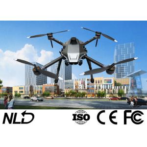
4 Rotors 4KG UAV Aerial Inspection Drone For Power Line Inspection

|
Power Line Inspection Drone with 1080P Visiable Light Camera 1/3" Panasonic CMOS Sensor Camera Description Q10T features 10x optical zoom and auto tracking function. It is a 3-axis gimbal camera for UAV, especially for small drones which require light ......
NEW LANDLE TECHNOLOGY CO.,LTD
|
Power Line Inspection Aerial Mapping UAV LiDAR Drone Mapping 3D Data Collection Colored Point Cloud High Accuracy

|
Power Line Inspection Aerial Mapping UAV LiDAR Drone Mapping Colored Point Cloud High Accuracy Geosun gAirHawk Series GS-260X UAV LiDAR Scanning System gAirHawk GS-260X is a kind of Mid-range, compact LiDAR point cloud data acquisition system, integrated ......
Wuhan Geosun Navigation Technology Co., Ltd.
|
Carbon Fiber Composite Airframe Material UAV VTOL 18kg Maximum Takeoff Weight with Omnidirectional Obstacle Sensing System

|
...UAV VTOL is an innovative Aerial Quadcopter Drone that combines the efficiency of vertical take-off and landing (VTOL) technology with the versatility of a fixed-wing aircraft. This cutting-edge Aerial Inspection Drone is designed for professional users looking for a reliable and high-performance solution for various applications, including aerial photography, surveying, mapping......
UAV-KIT Corporation Ltd
|
NLos Encryption Unmanned Aerial Vehicles Drone Video Transmission For Electricity Inspection

|
...UAV battery life, distance restrictions and other reasons, leading to the current market Most of UAV distance is very limited. Common aerial range is 2 km, but actually when the UAV flew to 2 km, the UAV aerial photography equipment has become powerless,...
LinkAV Technology Co., Ltd
|
